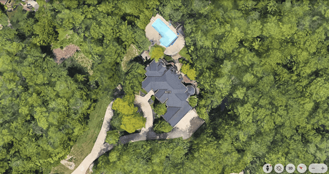
01 — Screenshot
Take a screenshot on Google Earth
Open Google Maps or Google Earth, find the property, tilt to any angle, capture. Works on every address in the MLS.
 videotour.aiTry for Free
Paste the address. Drop a Google Earth screenshot and one photo of the front of the house. Our AI builds a real estate drone video of the property. No pilot, no weather, no 3 day wait.
First video free. No credit card. No editor.How it works
Drone photography for real estate, on demand. Open the Location tab inside any VideoTour.ai project. The feature is baked in, no plugins, no setup.
01 — Screenshot
Open Google Maps or Google Earth, find the property, tilt to any angle, capture. Works on every address in the MLS.
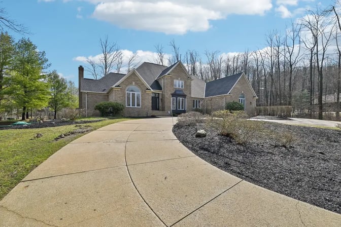
02 — Reference
The front elevation the homeowner already sent you. The AI uses it to rebuild the roof, windows, and structure so the drone shot actually matches the property.
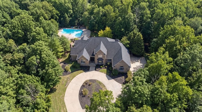
03 — Output
Drone photo for the MLS. Drone video for Reels and TikTok. Same address, same angle, delivered in about a minute.
Generated on demand
Two formats, one flight
Switch the aspect ratio in the editor and regenerate. Same angle, same roof, same tree line. One address, every channel.
16 : 9 · MLS
Drone footage for the real estate listing carousel, MLS embed, YouTube, Vimeo, or any agent CRM that accepts H.264.
9 : 16 · REELS
Same shot re-framed for Reels, TikTok, and Stories. Post-ready the moment it renders.
No pilot · no FAA
Classic aerial real estate photography means a licensed drone photographer, a weather window, a one hour shoot, and a three day turnaround. Most realtors skip it on anything under a million dollars because the math does not work.
AI Drone View closes that gap. One photo in, a cinematic aerial view of your property out. Every listing gets a drone shot now, not just the luxury ones.
Watch it in action
A working realtor uses the Location tab end-to-end. Same 3-step flow you just read. Real product, real output, no fake demo.
Drone photography pricing
Turnaround: 2 to 3 days
Weather dependent: Yes, cancellations cost time
Scheduling: Calls, quotes, site visits
Geography: Local pilots only
Formats delivered: One aspect, one shot
FAA license required: Yes, Part 107
Turnaround: Under 60 seconds
Weather dependent: No, works any day
Scheduling: Two file uploads
Geography: Any property in the MLS
Formats delivered: 16:9 · 9:16 · 1:1
FAA license required: None
Frequently asked
Professional real estate drone photography in the US runs from about $150 for a basic photo-only shoot on a small residential lot, up to $650 or more for a full video package on luxury or commercial listings. Most realtors land around $300 to $450 per shoot for a typical single-family listing with photos and a 30-60 second video.
On top of the pilot fee, expect a 2-3 day scheduling window and weather-related rescheduling on rainy weeks. AI Drone View produces the same deliverable in under a minute, from a single uploaded photo, at a fraction of the cost.
For agents who still fly their own, the DJI Mavic 3 Pro and the DJI Air 3 are the current consensus picks for real estate drone photography — strong camera, three focal lengths, under the FAA 250g registration line in the Mini 4 Pro variant. Expect $800 to $2,200 depending on the model and kit, plus a Part 107 license if you are flying for paid work.
Most agents never touch the drone themselves. They either hire a pilot or, increasingly, generate the aerial shot directly from a ground-level photo using AI Drone View.
US freelance drone pilots charge $150 to $250 per hour or flat-rate packages at $250 to $500 per listing for photos plus a short aerial video. Commercial and luxury listings can push past $800. Pricing depends on local market, pilot experience, and whether post-production is included.
The same aerial real estate photography output, produced from a Google Earth screenshot and a ground-level photo of the house, is available on VideoTour.ai for a small credit charge and delivered in under a minute.
Your first video is free
Start with one listing. If the flyover doesn't read as real, you walk away. No card, no commitment.
No credit card required · cancel in one click